MY GIS WORKS
Welcome to a curated collection of my geospatial analysis projects.
Each project integrates GIS, remote sensing, and cartographic storytelling.
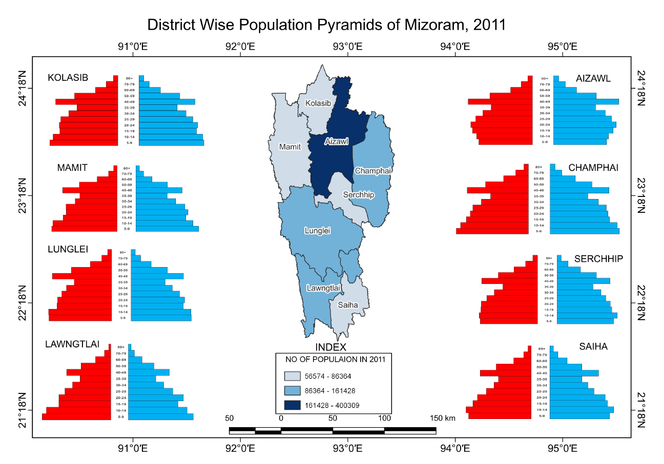
Population Distribution in Mizoram
Visualisation of urban road networks for four major Indian cities using OSMnx and Matplotlib. Highlights spatial morphology through minimalist mapping