Visuals
This map highlights dense population zones and their interaction with infrastructure corridors in Mizoram.
A GIS-based analysis using remote sensing and zonal statistics
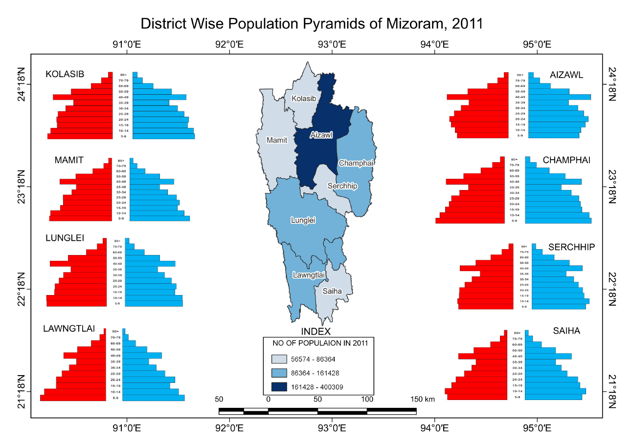
This project explores the spatial distribution of population and the urban influence zones within Mizoram. Using GIS-based cartographic methods, it analyzes population clusters and their relation to transport corridors and urban hubs.
This map highlights dense population zones and their interaction with infrastructure corridors in Mizoram.
The study reveals pronounced spatial imbalance in population settlement, emphasizing the need for more equitable development planning in Mizoram.